Le Périer topographic map
Interactive map
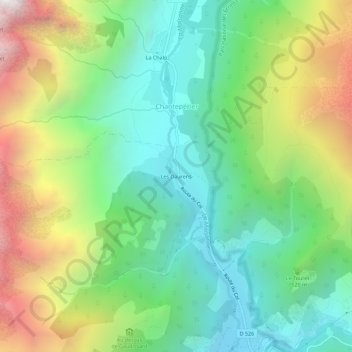
Click on the map to display elevation.
About this map
Name: Le Périer topographic map, elevation, terrain.
Average elevation: 5,052 ft
Minimum elevation: 2,907 ft
Maximum elevation: 9,009 ft

Click on the map to display elevation.
Name: Le Périer topographic map, elevation, terrain.
Average elevation: 5,052 ft
Minimum elevation: 2,907 ft
Maximum elevation: 9,009 ft