Celliers topographic map
Interactive map
Click on the map to display elevation.
About this map
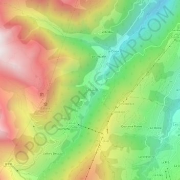
Name: Celliers topographic map, elevation, terrain.
Average elevation: 4,715 ft
Minimum elevation: 2,723 ft
Maximum elevation: 7,159 ft

Click on the map to display elevation.
Name: Celliers topographic map, elevation, terrain.
Average elevation: 4,715 ft
Minimum elevation: 2,723 ft
Maximum elevation: 7,159 ft