
Legua topographic map
Interactive map
Click on the map to display elevation.
About this map
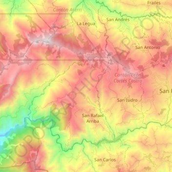
Name: Legua topographic map, elevation, terrain.
Location: Legua, Cantón Aserrí, Provincia San José, 10605, Costa Rica (9.62098 -84.22468 9.75406 -84.09152)
Average elevation: 5,197 ft
Minimum elevation: 1,650 ft
Maximum elevation: 8,143 ft