
Thank you for supporting this site ❤️
Make a donation
Make a donation
Gear up for your next adventure:
As an Amazon Associate, this site earns from qualifying purchases at no extra cost to you.
Lenno topographic map
Click on the map to display elevation.
Thank you for supporting this site ❤️
Make a donation
Make a donation
Gear up for your next adventure:
As an Amazon Associate, this site earns from qualifying purchases at no extra cost to you.
About this map
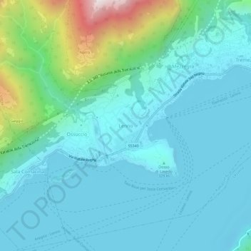
Name: Lenno topographic map, elevation, terrain.
Location: Lenno, Tremezzina, Como, Lombardy, 22016, Italy (45.95298 9.17084 45.99298 9.21084)
Average elevation: 1,253 ft
Minimum elevation: 604 ft
Maximum elevation: 4,386 ft
Thank you for supporting this site ❤️
Make a donation
Make a donation
Gear up for your next adventure:
As an Amazon Associate, this site earns from qualifying purchases at no extra cost to you.