
Nieuwersluis topographic map
Interactive map
Click on the map to display elevation.
About this map
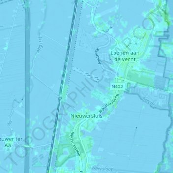
Name: Nieuwersluis topographic map, elevation, terrain.
Location: Nieuwersluis, Stichtse Vecht, Utrecht, Nederland (52.18411 4.98742 52.22205 5.03817)
Average elevation: -3 ft
Minimum elevation: -16 ft
Maximum elevation: 16 ft