
Pehuajó topographic map
Interactive map
Click on the map to display elevation.
About this map
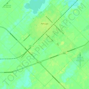
Name: Pehuajó topographic map, elevation, terrain.
Location: Pehuajó, Partido de Pehuajó, Buenos Aires, Argentina (-35.84064 -61.92280 -35.79102 -61.85860)
Average elevation: 282 ft
Minimum elevation: 256 ft
Maximum elevation: 302 ft