
Windisch Bleiberg topographic map
Interactive map
Click on the map to display elevation.
About this map
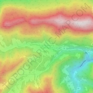
Name: Windisch Bleiberg topographic map, elevation, terrain.
Average elevation: 3,648 ft
Minimum elevation: 2,178 ft
Maximum elevation: 5,118 ft
Other topographic maps
Click on a map to view its topography, its elevation and its terrain.
Waidisch
Österreich > Kärnten > Bezirk Klagenfurt-Land > Ferlach
Waidisch, Ferlach, Bezirk Klagenfurt-Land, Kärnten, 9170, Österreich
Average elevation: 3,173 ft