
Frenda topographic map
Interactive map
Click on the map to display elevation.
About this map
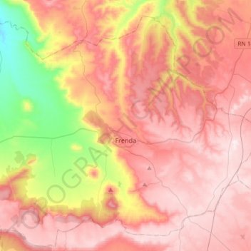
Name: Frenda topographic map, elevation, terrain.
Location: Frenda, daïra Frenda, Tiaret, Algérie (34.97447 0.92074 35.18456 1.21365)
Average elevation: 3,376 ft
Minimum elevation: 2,169 ft
Maximum elevation: 4,180 ft
Frenda est située à une altitude de plus de 1 000 m et présente donc un climat sec avec un été très chaud et un hiver froid et rugueux.