
North Hillsdale topographic map
Interactive map
Click on the map to display elevation.
About this map
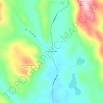
Name: North Hillsdale topographic map, elevation, terrain.
Average elevation: 1,010 ft
Minimum elevation: 732 ft
Maximum elevation: 1,601 ft
Other topographic maps
Click on a map to view its topography, its elevation and its terrain.
Harlemville
United States > New York > Columbia County > Town of Hillsdale
Harlemville, Town of Hillsdale, Columbia County, New York, 42529, United States
Average elevation: 807 ft