
Mönchegg topographic map
Interactive map
Click on the map to display elevation.
About this map
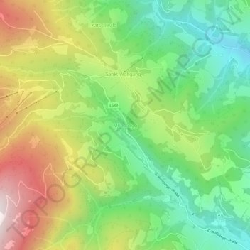
Name: Mönchegg topographic map, elevation, terrain.
Location: Mönchegg, Obdach, Bezirk Murtal, Steiermark, 8742, Österreich (47.06902 14.61505 47.10902 14.65505)
Average elevation: 4,058 ft
Minimum elevation: 2,815 ft
Maximum elevation: 5,892 ft