
南灣湖 topographic map
Interactive map
Click on the map to display elevation.
About this map
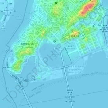
Name: 南灣湖 topographic map, elevation, terrain.
Location: 南灣湖, 新城 B 區, 大堂區, 澳門市, 澳門, 中国 (22.18276 113.53803 22.18994 113.54669)
Average elevation: 26 ft
Minimum elevation: -23 ft
Maximum elevation: 266 ft