
River Otter topographic map
Interactive map
Click on the map to display elevation.
About this map
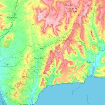
Name: River Otter topographic map, elevation, terrain.
Average elevation: 328 ft
Minimum elevation: -10 ft
Maximum elevation: 961 ft
Other topographic maps
Click on a map to view its topography, its elevation and its terrain.
Beacon
Vereinigtes Königreich > England > Devon > East Devon
Beacon, East Devon, Devon, England, EX14 4TU, Vereinigtes Königreich
Average elevation: 568 ft