
甘雨庄 topographic map
Interactive map
Click on the map to display elevation.
About this map
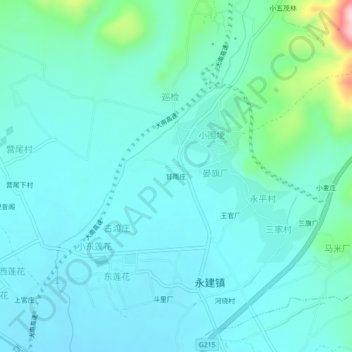
Name: 甘雨庄 topographic map, elevation, terrain.
Location: 甘雨庄, 晏旗厂, 永建镇, 巍山彝族回族自治县, 大理白族自治州, 云南省, 中国 (25.41954 100.18915 25.45954 100.22915)
Average elevation: 5,866 ft
Minimum elevation: 5,735 ft
Maximum elevation: 6,549 ft