
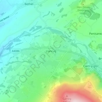
Llanrug topographic map
Interactive map
Click on the map to display elevation.
About this map
Name: Llanrug topographic map, elevation, terrain.
Location: Llanrug, Gwynedd, Wales, LL55 4PN, United Kingdom (53.12673 -4.21186 53.16673 -4.17186)
Average elevation: 427 ft
Minimum elevation: 180 ft
Maximum elevation: 1,214 ft