Geolocate

Framingham Center topographic map

Click on the map to display elevation.

About this map
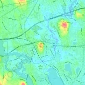
Name: Framingham Center topographic map, elevation, terrain.

Location: Framingham Center, Framingham, Middlesex County, Massachusetts, 01702, United States (42.28063 -71.45511 42.32063 -71.41511)

Average elevation: 190 ft

Minimum elevation: 144 ft

Maximum elevation: 331 ft

Middlesex County trails, hiking, mountain biking, running and outdoor activities

Gear up for your next adventure:

📻Weather Alert Radios - Stay informed of storm risks while off-the-grid
🔋Solar Power Banks - Keep your GPS and phone charged in remote wilderness areas
🍳Camping Cook Set - Complete cookware for outdoor meals
🚁Photography Drones - Capture stunning aerial views of landforms and topography
🦟Ultrasonic Repellers - Create a bug-free zone at your camp or rest stop

As an Amazon Associate, this site earns from qualifying purchases at no extra cost to you.