
Prangins topographic map
Interactive map
Click on the map to display elevation.
About this map
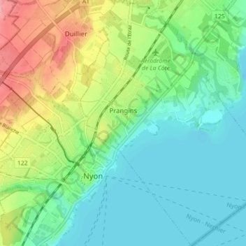
Name: Prangins topographic map, elevation, terrain.
Location: Prangins, District de Nyon, Waadt, 1197, Schweiz (46.38689 6.23652 46.41629 6.27783)
Average elevation: 1,365 ft
Minimum elevation: 1,214 ft
Maximum elevation: 1,542 ft