
Monte Valcorchero topographic map
Interactive map
Click on the map to display elevation.
About this map
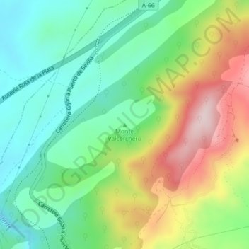
Name: Monte Valcorchero topographic map, elevation, terrain.
Average elevation: 1,358 ft
Minimum elevation: 919 ft
Maximum elevation: 2,110 ft
Other topographic maps
Click on a map to view its topography, its elevation and its terrain.
Parque de Monfragüe
España > Extremadura > Plasencia
Parque de Monfragüe, El Berrocal, Plasencia, Cáceres, Extremadura, España
Average elevation: 1,227 ft