Geolocate

General Escobedo topographic map

Click on the map to display elevation.

About this map
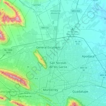
Name: General Escobedo topographic map, elevation, terrain.

Location: General Escobedo, Nuevo León, 66053, Mexico (25.64852 -100.48243 25.96852 -100.16243)

Average elevation: 1,952 ft

Minimum elevation: 1,214 ft

Maximum elevation: 6,673 ft

Gear up for your next adventure:

📻Weather Alert Radios - Stay informed of storm risks while off-the-grid
🕶️Glacier Sunglasses - Side shields to protect eyes from high-altitude snow glare
⌚GPS Sports Watch - GPS watch for running, hiking and training
🗺️NatGeo Topo Maps - High-quality waterproof printed topographic maps of US Parks
🔭Compact Binoculars - HD vision for scouting terrain and identifying distant landmarks

As an Amazon Associate, this site earns from qualifying purchases at no extra cost to you.