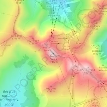
Puy de Sancy topographic map
Interactive map
Click on the map to display elevation.
About this map
Name: Puy de Sancy topographic map, elevation, terrain.
Average elevation: 5,253 ft
Minimum elevation: 4,350 ft
Maximum elevation: 6,142 ft

Click on the map to display elevation.
Name: Puy de Sancy topographic map, elevation, terrain.
Average elevation: 5,253 ft
Minimum elevation: 4,350 ft
Maximum elevation: 6,142 ft