
Ogrodzona topographic map
Interactive map
Click on the map to display elevation.
About this map
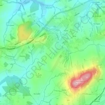
Name: Ogrodzona topographic map, elevation, terrain.
Average elevation: 1,109 ft
Minimum elevation: 945 ft
Maximum elevation: 1,496 ft
Other topographic maps
Click on a map to view its topography, its elevation and its terrain.
Cieszyn
Poland > Silesian Voivodeship > Cieszyn County > Zamarski
Cieszyn, Zamarski, gmina Hażlach, Cieszyn County, Silesian Voivodeship, 43-400, Poland
Average elevation: 1,027 ft