
Acevedo topographic map
Interactive map
Click on the map to display elevation.
About this map
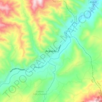
Name: Acevedo topographic map, elevation, terrain.
Location: Acevedo, Sur, Huila, Colombia (1.76705 -75.92850 1.84705 -75.84850)
Average elevation: 4,344 ft
Minimum elevation: 3,419 ft
Maximum elevation: 6,086 ft