
Gunung Tampomas topographic map
Interactive map
Click on the map to display elevation.
About this map
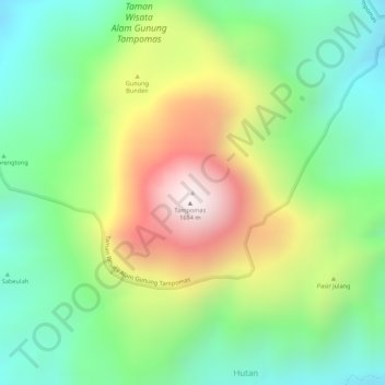
Name: Gunung Tampomas topographic map, elevation, terrain.
Location: Gunung Tampomas, Sumedang, West-Java, Indonesien (-6.76377 107.96053 -6.76367 107.96063)
Average elevation: 4,098 ft
Minimum elevation: 3,133 ft
Maximum elevation: 5,486 ft
Other topographic maps
Click on a map to view its topography, its elevation and its terrain.
Sumedang
Indonesien > West-Java > Sumedang
Sumedang, West-Java, 45321, Indonesien
Average elevation: 2,234 ft