
Denderwindeke topographic map
Interactive map
Click on the map to display elevation.
About this map
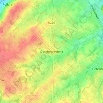
Name: Denderwindeke topographic map, elevation, terrain.
Location: Denderwindeke, Ninove, Aalst, Oost-Vlaanderen, 9400, België (50.77862 4.00414 50.81862 4.04414)
Average elevation: 138 ft
Minimum elevation: 33 ft
Maximum elevation: 223 ft