Geolocate

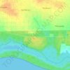
Genteng topographic map

Click on the map to display elevation.

About this map

Name: Genteng topographic map, elevation, terrain.

Location: Genteng, Banyuwangi, East Java, Java, 68465, Indonesia (-8.40410 114.10859 -8.32410 114.18859)

Average elevation: 558 ft

Minimum elevation: 367 ft

Maximum elevation: 827 ft

Other topographic maps

Click on a map to view its topography, its elevation and its terrain.

Red Island

Indonesia > East Java > Banyuwangi

Average elevation: 102 ft

Baluran National Park

Indonesia > East Java > Banyuwangi > Bimorejo

Average elevation: 449 ft

DESA KALIPAIT

Indonesia > East Java > Banyuwangi

Average elevation: 154 ft

DESA SUMBERASRI

Indonesia > East Java > Banyuwangi

Average elevation: 43 ft

Gear up for your next adventure:

🚁Photography Drones - Capture stunning aerial views of landforms and topography
🧯Portable Fire Pit - Compact fire pit for camping spots
🌐World Map Poster - Decorative world maps with topographic info
🔋Solar Power Banks - Keep your GPS and phone charged in remote wilderness areas
🏕️Family Camping Gear - Essentials for group camping trips

As an Amazon Associate, this site earns from qualifying purchases at no extra cost to you.