
Hochheim am Main topographic map
Interactive map
Click on the map to display elevation.
About this map
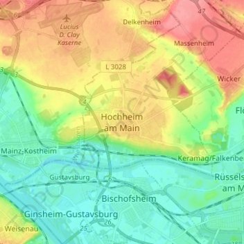
Name: Hochheim am Main topographic map, elevation, terrain.
Location: Hochheim am Main, Main-Taunus-Kreis, Hesse, 65239, Germany (49.97455 8.31145 50.05455 8.39145)
Average elevation: 367 ft
Minimum elevation: 266 ft
Maximum elevation: 525 ft