Geolocate

Clarksville topographic map

Click on the map to display elevation.

About this map
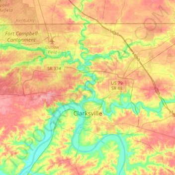
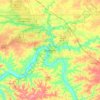
Name: Clarksville topographic map, elevation, terrain.

Location: Clarksville, Montgomery County, Middle Tennessee, Tennessee, United States (36.47867 -87.48242 36.64176 -87.20587)

Average elevation: 509 ft

Minimum elevation: 354 ft

Maximum elevation: 656 ft

Montgomery County trails, hiking, mountain biking, running and outdoor activities

Other topographic maps

Click on a map to view its topography, its elevation and its terrain.

Needmore

United States > Tennessee > Montgomery County

Average elevation: 558 ft

Woodlawn

United States > Tennessee > Montgomery County

Average elevation: 607 ft

Oakridge

United States > Tennessee > Montgomery County

Average elevation: 636 ft

Cunningham

United States > Tennessee > Montgomery County

Average elevation: 643 ft

Oakridge

United States > Tennessee > Montgomery County

Average elevation: 636 ft

Shiloh

United States > Tennessee > Montgomery County > Shiloh

Average elevation: 568 ft

Gear up for your next adventure:

🚗GPS Dash Cams - Record your scenic drives through mountain passes and canyons
📱Solar Portable Charger - Solar power bank for charging devices off‑grid
📷Action Camera - Capture your outdoor adventures in HD
🎒Day Hiking Backpack - Lightweight backpack perfect for day trips and outdoor adventures
🧭Outdoor Navigation Book - Learn advanced navigation skills

As an Amazon Associate, this site earns from qualifying purchases at no extra cost to you.