
Konstanz-Dingelsdorf topographic map
Interactive map
Click on the map to display elevation.
About this map
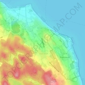
Name: Konstanz-Dingelsdorf topographic map, elevation, terrain.
Average elevation: 1,421 ft
Minimum elevation: 1,286 ft
Maximum elevation: 1,677 ft
Other topographic maps
Click on a map to view its topography, its elevation and its terrain.
Konstanz-Königsbau
Deutschland > Baden-Württemberg > Landkreis Konstanz > Konstanz
Konstanz-Königsbau, Konstanz, Verwaltungsgemeinschaft Konstanz, Landkreis Konstanz, Baden-Württemberg, Deutschland
Average elevation: 1,398 ft