
Tenkiller Ferry Lake topographic map
Interactive map
Click on the map to display elevation.
About this map
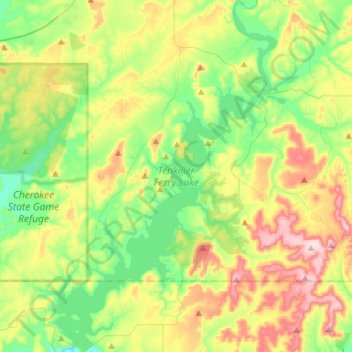
Name: Tenkiller Ferry Lake topographic map, elevation, terrain.
Average elevation: 846 ft
Minimum elevation: 492 ft
Maximum elevation: 1,470 ft
The hydroelectric power station is remotely controlled from the control center at Fort Gibson Lake. Two generators, each rated for 17 megawatts, provide a total capacity of 34 megawatts (MWe). The facility can handle 40 MWe for a short period of time. However, the amount of power that can actually be generated depends heavily on the lake elevation at any given time.