
Mettlach topographic map
Interactive map
Click on the map to display elevation.
About this map
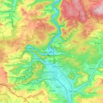
Name: Mettlach topographic map, elevation, terrain.
Location: Mettlach, Landkreis Merzig-Wadern, Sarre, 66693, Allemagne (49.44610 6.44728 49.54449 6.65760)
Average elevation: 1,037 ft
Minimum elevation: 482 ft
Maximum elevation: 1,877 ft
Other topographic maps
Click on a map to view its topography, its elevation and its terrain.
Losheim-au-Lac
Allemagne > Sarre > Landkreis Merzig-Wadern
Losheim-au-Lac, Landkreis Merzig-Wadern, Sarre, 66679, Allemagne
Average elevation: 1,135 ft