
Dosso del Liro topographic map
Interactive map
Click on the map to display elevation.
About this map
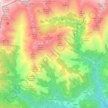
Name: Dosso del Liro topographic map, elevation, terrain.
Location: Dosso del Liro, Como, Lombardei, Italien (46.15772 9.19483 46.23341 9.28286)
Average elevation: 4,357 ft
Minimum elevation: 856 ft
Maximum elevation: 8,448 ft