
Guttenberg topographic map
Interactive map
Click on the map to display elevation.
About this map
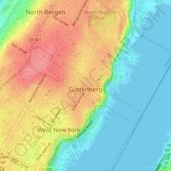
Name: Guttenberg topographic map, elevation, terrain.
Location: Guttenberg, Hudson County, New Jersey, USA (40.78630 -74.01566 40.79889 -73.99162)
Average elevation: 118 ft
Minimum elevation: -7 ft
Maximum elevation: 269 ft