
Thank you for supporting this site ❤️
Make a donation
Make a donation
Gear up for your next adventure:
As an Amazon Associate, this site earns from qualifying purchases at no extra cost to you.
Kollnburg topographic map
Click on the map to display elevation.
Thank you for supporting this site ❤️
Make a donation
Make a donation
Gear up for your next adventure:
As an Amazon Associate, this site earns from qualifying purchases at no extra cost to you.
About this map
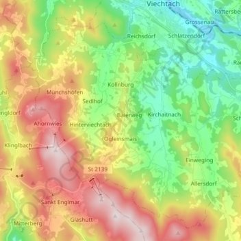
Name: Kollnburg topographic map, elevation, terrain.
Location: Kollnburg, Landkreis Regen, Bavaria, 94262, Germany (48.99091 12.80475 49.07652 12.95033)
Average elevation: 2,198 ft
Minimum elevation: 1,332 ft
Maximum elevation: 3,425 ft
Thank you for supporting this site ❤️
Make a donation
Make a donation
Gear up for your next adventure:
As an Amazon Associate, this site earns from qualifying purchases at no extra cost to you.