
Warbach topographic map
Interactive map
Click on the map to display elevation.
About this map
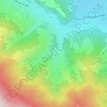
Name: Warbach topographic map, elevation, terrain.
Location: Warbach, Obdach, Bezirk Murtal, Steiermark, 8742, Österreich (47.04816 14.66082 47.06816 14.68082)
Average elevation: 3,635 ft
Minimum elevation: 2,851 ft
Maximum elevation: 4,993 ft
Other topographic maps
Click on a map to view its topography, its elevation and its terrain.
Zirbitzkogel
Österreich > Steiermark > Bezirk Murtal > Obdach
Zirbitzkogel, Obdach, Bezirk Murtal, Steiermark, 8742, Österreich
Average elevation: 6,788 ft