
Zenia topographic map
Click on the map to display elevation.
About this map
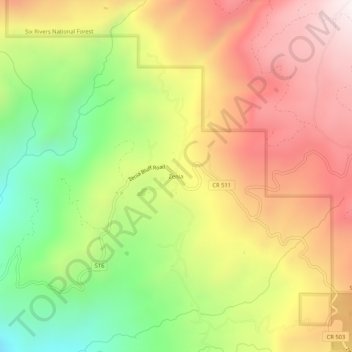
Name: Zenia topographic map, elevation, terrain.
Location: Zenia, Trinity County, California, 95595, United States (40.18542 -123.51197 40.22542 -123.47197)
Average elevation: 2,943 ft
Minimum elevation: 1,220 ft
Maximum elevation: 4,551 ft
Trinity County trails, hiking, mountain biking, running and outdoor activities
Other topographic maps
Click on a map to view its topography, its elevation and its terrain.
Whiskeytown-Shasta-Trinity National Recreation Area - Trinity Unit
United States > California > Trinity County
Average elevation: 3,770 ft