
Sterkrade topographic map
Interactive map
Click on the map to display elevation.
About this map
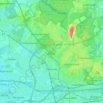
Name: Sterkrade topographic map, elevation, terrain.
Location: Sterkrade, Oberhausen, Nordrhein-Westfalen, Deutschland (51.48535 6.77733 51.57999 6.87949)
Average elevation: 161 ft
Minimum elevation: 69 ft
Maximum elevation: 558 ft
Other topographic maps
Click on a map to view its topography, its elevation and its terrain.
Oberhausen
Deutschland > Nordrhein-Westfalen > Oberhausen
Oberhausen, Regierungsbezirk Düsseldorf, Nordrhein-Westfalen, 46045, Deutschland
Average elevation: 194 ft