
Castel topographic map
Interactive map
Click on the map to display elevation.
About this map
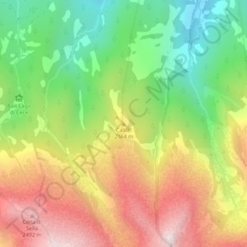
Name: Castel topographic map, elevation, terrain.
Average elevation: 6,578 ft
Minimum elevation: 5,020 ft
Maximum elevation: 8,373 ft
Other topographic maps
Click on a map to view its topography, its elevation and its terrain.
Predazzo
Italy > Trentino-Alto Adige/Südtirol > Predazzo > Predazzo
Predazzo, Comunità territoriale della Val di Fiemme, Provincia di Trento, Trentino-Alto Adige/Südtirol, 38037, Italy
Average elevation: 5,607 ft