Geolocate

Meppen topographic map

Click on the map to display elevation.

About this map
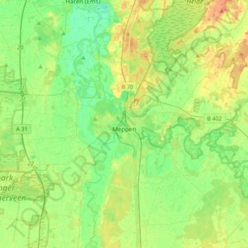
Name: Meppen topographic map, elevation, terrain.

Location: Meppen, Landkreis Emsland, Lower Saxony, 49716, Germany (52.62253 7.13514 52.77429 7.44119)

Average elevation: 62 ft

Minimum elevation: 16 ft

Maximum elevation: 128 ft

Gear up for your next adventure:

📻Weather Alert Radios - Stay informed of storm risks while off-the-grid
🛡️Insect Repellent - Protection against bugs during outdoor activities
👟Trail Running Shoes - Lightweight shoes for trail runners
🧭Hiking Compass - Precision compass for reliable navigation in the wilderness
🧭Compass with Lanyard - Easy‑carry compass for navigation

As an Amazon Associate, this site earns from qualifying purchases at no extra cost to you.