
Pirrera topographic map
Interactive map
Click on the map to display elevation.
About this map
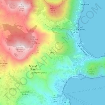
Name: Pirrera topographic map, elevation, terrain.
Location: Pirrera, Canneto, Lipari, Messine, Sicile, Italie (38.46712 14.92912 38.50712 14.96912)
Average elevation: 669 ft
Minimum elevation: 0 ft
Maximum elevation: 1,903 ft
Other topographic maps
Click on a map to view its topography, its elevation and its terrain.