
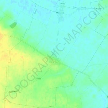
Dancy topographic map
Interactive map
Click on the map to display elevation.
About this map
Name: Dancy topographic map, elevation, terrain.
Average elevation: 449 ft
Minimum elevation: 420 ft
Maximum elevation: 502 ft
Other topographic maps
Click on a map to view its topography, its elevation and its terrain.
L'Ozanne
France > Centre-Val de Loire > Eure-et-Loir > Beaumont-les-Autels
L'Ozanne, Beaumont-les-Autels, Nogent-le-Rotrou, Eure-et-Loir, Centre-Val de Loire, France métropolitaine, 28480, France
Average elevation: 728 ft
Guainville
France > Centre-Val de Loire > Eure-et-Loir
Guainville, Dreux, Eure-et-Loir, Centre-Val de Loire, France métropolitaine, 28260, France
Average elevation: 374 ft
Le Coudray
France > Centre-Val de Loire > Eure-et-Loir
Le Coudray, Chartres, Eure-et-Loir, Centre-Val de Loire, France métropolitaine, 28630, France
Average elevation: 472 ft