
Las Brisas topographic map
Interactive map
Click on the map to display elevation.
About this map
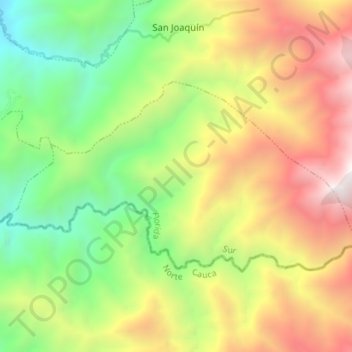
Name: Las Brisas topographic map, elevation, terrain.
Location: Las Brisas, Florida, Sur, Valle del Cauca, Colombia (3.22200 -76.18045 3.26023 -76.10968)
Average elevation: 8,012 ft
Minimum elevation: 4,587 ft
Maximum elevation: 12,425 ft
Other topographic maps
Click on a map to view its topography, its elevation and its terrain.
La Rivera
Colombia > Valle del Cauca > Florida
La Rivera, Florida, Sur, Valle del Cauca, RAP Pacífico, Colombia
Average elevation: 9,469 ft