Geolocate

Haedo topographic map

Click on the map to display elevation.

About this map
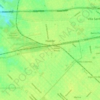
Name: Haedo topographic map, elevation, terrain.

Location: Haedo, Partido de Morón, Buenos Aires, 1706, Argentina (-34.65986 -58.62187 -34.63314 -58.57763)

Average elevation: 92 ft

Minimum elevation: 56 ft

Maximum elevation: 102 ft

Other topographic maps

Click on a map to view its topography, its elevation and its terrain.

Pinamar

Argentina > Buenos Aires

Average elevation: 20 ft

San Pedro

Argentina > Buenos Aires

Average elevation: 43 ft

Gobernador Udaondo

Argentina > Buenos Aires

Average elevation: 92 ft

Mechongué

Argentina > Buenos Aires

Average elevation: 203 ft

Altamira

Argentina > Buenos Aires

Average elevation: 128 ft

Nautica Trento

Argentina > Buenos Aires > Victoria

Average elevation: 30 ft

Moll

Argentina > Buenos Aires

Average elevation: 135 ft

Gear up for your next adventure:

🌎3D Topographic Globes - Raised relief globes for a tactile understanding of geography
🧭Map Reading Tools - Tools and kits for map navigation
🧢Sun Protection Hats - Wide-brimmed and UPF-rated hats for high-altitude sun safety
🔦LED Headlamp - Bright and durable LED headlamp for night navigation
🧭Compass with Lanyard - Easy‑carry compass for navigation

As an Amazon Associate, this site earns from qualifying purchases at no extra cost to you.