
Le Clotes topographic map
Interactive map
Click on the map to display elevation.
About this map
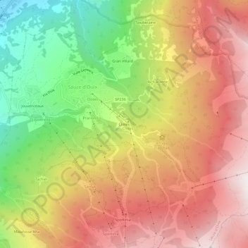
Name: Le Clotes topographic map, elevation, terrain.
Location: Le Clotes, Sauze d'Oulx, Turin, Piémont, 10056, Italie (45.00098 6.84786 45.04098 6.88786)
Average elevation: 5,879 ft
Minimum elevation: 3,471 ft
Maximum elevation: 7,930 ft