
Le Marais topographic map
Interactive map
Click on the map to display elevation.
About this map
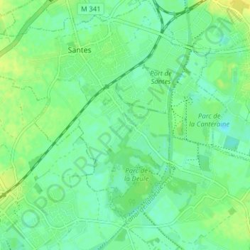
Name: Le Marais topographic map, elevation, terrain.
Average elevation: 75 ft
Minimum elevation: 49 ft
Maximum elevation: 108 ft
Other topographic maps
Click on a map to view its topography, its elevation and its terrain.
La Rache
France > Hauts-de-France > Nord > Santes
La Rache, Santes, Lille, Nord, Hauts-de-France, France métropolitaine, 59211, France
Average elevation: 79 ft
Saint-Pierre
France > Hauts-de-France > Nord > Santes
Saint-Pierre, Santes, Lille, Nord, Hauts-de-France, France métropolitaine, 59211, France
Average elevation: 85 ft