
Collin topographic map
Interactive map
Click on the map to display elevation.
About this map
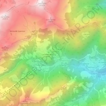
Name: Collin topographic map, elevation, terrain.
Location: Collin, Champorcher, Vallée d'Aoste, Italie (45.60664 7.59509 45.64664 7.63509)
Average elevation: 5,925 ft
Minimum elevation: 3,757 ft
Maximum elevation: 8,225 ft
Other topographic maps
Click on a map to view its topography, its elevation and its terrain.
Chardonney
Italie > Vallée d'Aoste > Champorcher
Chardonney, Champorcher, Vallée d'Aoste, Italie
Average elevation: 6,115 ft