Clever topographic map
Click on the map to display elevation.
Clever
Clever is located on the Springfield Plateau of the Missouri Ozarks, 14.5 miles (23.3 km) southwest of Springfield at an elevation of 1,398 feet (426 m). The town lies in the western panhandle of Christian County, just south of Missouri Highway 14 between Nixa and Billings. The town of Republic and the Wilson's Creek National Battlefield are approximately six miles to the north and northeast.
About this map
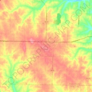
Name: Clever topographic map, elevation, terrain.
Location: Clever, Christian County, Missouri, United States (36.99394 -93.52779 37.07283 -93.41096)
Average elevation: 1,302 ft
Minimum elevation: 1,109 ft
Maximum elevation: 1,421 ft
Christian County trails, hiking, mountain biking, running and outdoor activities
Other topographic maps
Click on a map to view its topography, its elevation and its terrain.