
el Mondúver topographic map
Interactive map
Click on the map to display elevation.
About this map
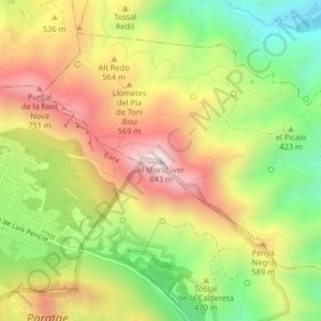
Name: el Mondúver topographic map, elevation, terrain.
Average elevation: 1,499 ft
Minimum elevation: 312 ft
Maximum elevation: 2,723 ft
Other topographic maps
Click on a map to view its topography, its elevation and its terrain.
Pla de la Marchuquera
España > Comunidad Valenciana > Jeresa
Pla de la Marchuquera, Jeresa, La Safor, Valencia, Comunidad Valenciana, 46790, España
Average elevation: 348 ft