
Pimenteira topographic map
Interactive map
Click on the map to display elevation.
About this map
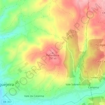
Name: Pimenteira topographic map, elevation, terrain.
Location: Pimenteira, Leiria, Pinhal Litoral, Centro, 2420-124, Portugal (39.75182 -8.69128 39.75192 -8.69118)
Average elevation: 564 ft
Minimum elevation: 328 ft
Maximum elevation: 791 ft
Other topographic maps
Click on a map to view its topography, its elevation and its terrain.