
Clarive topographic map
Interactive map
Click on the map to display elevation.
About this map
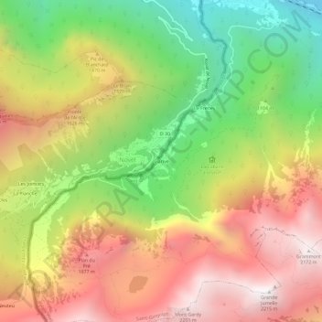
Name: Clarive topographic map, elevation, terrain.
Location: Clarive, Saint-Gingolph, Monthey, Valais, 1898, Suisse (46.34861 6.77466 46.38861 6.81466)
Average elevation: 4,219 ft
Minimum elevation: 1,211 ft
Maximum elevation: 7,126 ft