
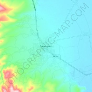
Cuerámaro topographic map
Interactive map
Click on the map to display elevation.
About this map
Name: Cuerámaro topographic map, elevation, terrain.
Location: Cuerámaro, Guanajuato, México (20.58545 -101.71239 20.66545 -101.63239)
Average elevation: 5,764 ft
Minimum elevation: 5,551 ft
Maximum elevation: 6,785 ft