Geolocate

Anchal topographic map

Click on the map to display elevation.

About this map
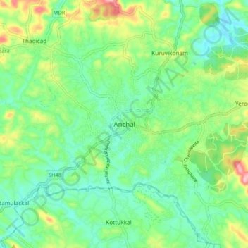
Name: Anchal topographic map, elevation, terrain.

Location: Anchal, Punalur, Kollam, Kerala, 691306, India (8.88927 76.86650 8.96927 76.94650)

Average elevation: 259 ft

Minimum elevation: 92 ft

Maximum elevation: 643 ft

Gear up for your next adventure:

🥄Camping Utensil Set - Lightweight utensils for outdoor meals
🔋Rechargeable Batteries - Power up your outdoor devices
🥾Hiking Shoes - Durable and comfortable shoes for trail hiking
🪶Survival Guide Book - Expert advice for emergency preparedness
🗃️Trail First Aid Kit - Essential kit for outdoor injuries and emergencies

As an Amazon Associate, this site earns from qualifying purchases at no extra cost to you.